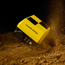
Propeller Launches App for On-Site Map Access
Propeller has introduced a new mobile application designed to extend its data platform directly into the field. The app enables construction and earthworks teams to access the latest project information without relying on laptops, which can often be impractical on active worksites. Users can view high-quality 3D maps, design files, and terrain data from their phones, helping to ensure decisions are based on the most up-to-date information available.
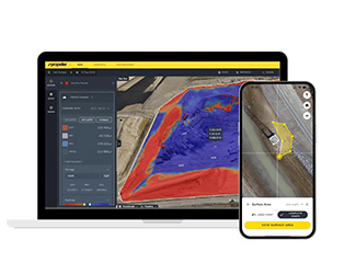
Among the core functions are real-time map access, distance and elevation measurements, and the ability to overlay designs directly onto the live worksite view. Workers can also orient themselves instantly by tracking their location against project maps, reducing delays caused by navigation or uncertainty on site. The app supports custom coordinate systems, allowing it to integrate with a wide range of workflows in civil construction and related projects.
According to Propeller, the app is intended to make actionable data more accessible for field teams, improving collaboration with office-based staff and minimizing the risk of rework caused by outdated information. By putting the platform into the hands of mobile users, the company highlights the potential to save time and enhance efficiency across project teams.
For more information
Categories: GPS - Surveying and Guidance
2025-08-28 | Propeller Aerobotics Pty Ltd | Australia | Views 523
More from Propeller Aerobotics Pty Ltd