Wingtra Unveils WingtraRAY Survey Drone

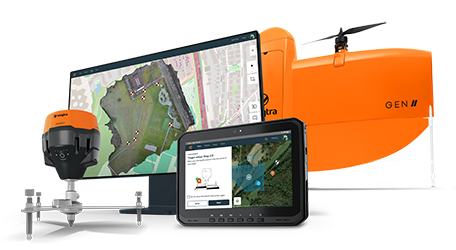
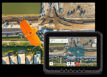
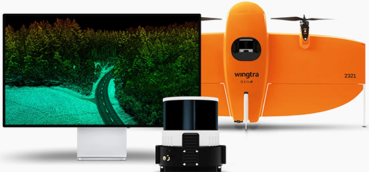
Wingtra has introduced the WingtraRAY, a fixed-wing vertical take-off and landing drone designed for professional surveying work. The company say that the system combines legal-compliant flight capabilities, including operation over people without a waiver, with an adaptable payload system that accommodates six different sensors. These can be used for applications ranging from millimetre-scale crack detection to LIDAR terrain mapping. Safety features such as obstacle avoidance and an integrated parachute are also included.
The WingtraRAY can survey up to 250 acres in around ten minutes, with a workflow intended to reduce repeat site visits and deliver processed data quickly. Connectivity and cloud-based processing are positioned as part of the platform’s end-to-end approach, intended to allow operators to work across varied environments—such as infrastructure projects, forestry, and active construction sites—using a single tool.
“We can talk all day about the impressive new features of WingtraRAY,” said Maximilian Boosfeld, CEO at Wingtra. “Yet we’ve learned that our survey customers care about results that solve their problems and fast return on their investment. They also need a solution that’s easy and safe for all of their pilots. With WingtraRAY, we offer these things in one cost-effective system that provides efficient analytics and GIS service deliverables.”
For more information
Categories: Drones Surveying Equipment
2025-08-21 | Wingtra AG | Switzerland | Views 877
More from Wingtra AG