 |
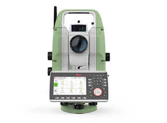
Leica TS20 Advances Surveying Automation
Leica Geosystems has introduced the Leica TS20, a robotic total station designed to enhance surveying productivity through advanced edge AI technology. The TS20 integrates AI-powered features such as…
2025-12-04 | Leica Geosystems AG | Switzerland
|
 |
IDS GeoRadar Introduces Opera XR for Advanced Utility Detection
IDS GeoRadar has unveiled Opera XR, a dual-antenna ground-penetrating radar (GPR) system designed for efficient utility detection. Incorporating the company’s patented Equalised scrambled Technology…
2025-08-15 | IDS GeoRadar s.r.l. | Italy
|
 |
- News Plus -
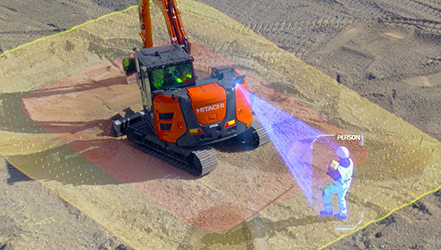
Leica Geosystems Unveils AI Safety Tool
Leica Geosystems, part of Hexagon, has launched the Leica Xsight360, a safety awareness system developed in partnership with Presien. Designed for heavy construction vehicles, the system uses multiple…
2025-06-30 | Leica Geosystems AG | Switzerland
|
 |
RIEGL Adds New Tools to RiSCAN PRO and RiPROCESS
RIEGL has announced updates to its software suites RiSCAN PRO and RiPROCESS, introducing new tools aimed at improving the processing and analysis of LiDAR data. The company says the enhancements support…
2025-05-28 | RIEGL Laser Measurement Systems GmbH | Austria
|
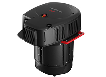 |
Leica Geosystems Introduces New Airborne Bathymetric LiDAR Solution
Leica Geosystems, part of Hexagon, has launched the Leica CoastalMapper, an airborne bathymetric LiDAR system designed to improve hydrographic survey efficiency. The system combines a high-performance…
2025-03-18 | Leica Geosystems AG | Switzerland
|
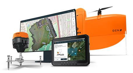 |
Wingtra Introduces WingtraGROUND
Wingtra has launched WingtraGROUND, an all-in-one survey kit designed to improve efficiency and accuracy in data collection. The kit includes receivers integrated with WingtraCLOUD, enabling a seamless…
2025-02-10 | Wingtra AG | Switzerland
|
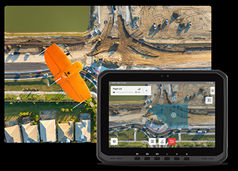 |
Wingtra Introduces Map Processing Capabilities for WingtraCLOUD
Wingtra has introduced a new update to its WingtraCLOUD platform, adding map processing capabilities. This upgrade is aimed at simplifying drone mapping operations by integrating mission planning, data…
2024-09-05 | Wingtra AG | Switzerland
|
 |
ExynAI Nexys: Precision Mapping and Visual Inspection for Construction
ExynAI’s Nexys offers a mobile mapping solution that combines LiDAR-based SLAM technology with ground control points (GCPs) to produce accurate 3D point clouds for construction sites. The use of GCPs…
2024-08-30 | Exyn Technologies | United States
|
 |
Leica Geosystems and JCB Join Forces
Leica Geosystems, part of Hexagon, and JCB have announced that they are joining forces to offer factory-fitted 2D and 3D-ready semi-automated excavator control solutions. The solutions, known as INTELLIGRADE,…
2024-04-18 | Leica Geosystems AG | Switzerland
|
 |
Leica Geosystems Partner with John Deere
John Deere has announced a strategic partnership with Leica Geosystems, part of Hexagon, to help accelerate the digital transformation of the heavy construction industry. The partnership between John…
2024-02-22 | Leica Geosystems AG | Switzerland
|
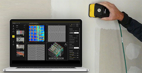 |
IDS GeoRadar launches Concrete Inspection Solutions
IDS GeoRadar, part of Hexagon, has announced its latest concrete scanning solutions at World of Concrete in Las Vegas. The C-thrue XS, is a handheld, dual polarisation GPR scanner for concrete inspection,…
2024-01-29 | IDS GeoRadar s.r.l. | Italy
|